Charlotte Douglas International Airport (CLT)
Orientation and Maps
(Charlotte, North Carolina (NC), USA)
The city of Charlotte is sited at the meeting point of two historic Indian trails and has a rich heritage, with a history of mining and banking. Nowadays, Charlotte has become one of the premier banking centers in the whole of America and boasts numerous high-rise buildings, many of which are connecting by raised walkways. Also Charlotte is known for being a city of business, there is also much for the tourists, including several appealing museums and plenty of places to eat out.
Located along the Josh Birmingham Parkway, the Charlotte Douglas International Airport (CLT) features a number of direct flights from Europe and numerous US destinations. Greyhound buses are available in the city and travel to Atlanta, Charleston and Washington DC, with the terminal standing along West Trade Street.
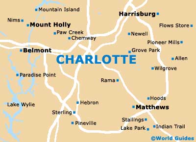
Charlotte Douglas Airport (CLT) Maps: Important City Districts
Amtrak trains are also available around, being located further away from central Charlotte, on North Tryon Street. Within the city itself, the Charlotte Area Transit operates a number of popular local bus services, providing inexpensive travel throughout the metropolitan region.
Important points of interest within central Charlotte include the visitors center along Tryon Street and close to West 2nd Street. A good place to visit when you first arrive in the city, here you will find useful local maps, a popular tourist guide and much more besides. Charlotte's public library lies on North College Street and offers free Internet access, opening Monday through Sunday.
USA Map

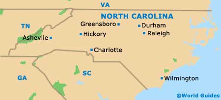
North Carolina Map
Charlotte Map